


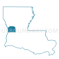
Precinct 1-8C, Vernon Parish, Louisiana
About
Outline

Summary
| Unique Area Identifier | 591250 |
| Name | Precinct 1-8C |
| County | Vernon Parish |
| State | Louisiana |
| Area (square miles) | 0.48 |
| Land Area (square miles) | 0.48 |
| Water Area (square miles) | 0.00 |
| % of Land Area | 99.80 |
| % of Water Area | 0.20 |
| Latitude of the Internal Point | 31.07678400 |
| Longtitude of the Internal Point | -93.26257350 |
Maps


Graphs
Select a template below for downloading or customizing gragh for Precinct 1-8C, Vernon Parish, Louisiana


Neighbors
Neighoring Voting District (by Name) Neighboring Voting District on the Map
- Precinct 1-8, Vernon Parish, LA
- Precinct 4-2, Vernon Parish, LA
- Precinct 4-3G, Vernon Parish, LA
- Precinct 4-3K, Vernon Parish, LA